
 Area
Area Category
 Spot
Spot Sort
Sort
- Buraneta
- Selections
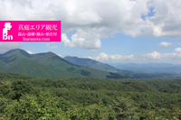
- 12 Scenic Mountain Climbs in Okayama Prefecture!
12 Scenic Mountain Climbs in Okayama Prefecture!
 (40) /
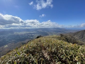
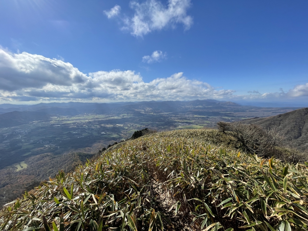
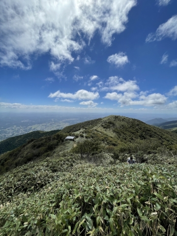
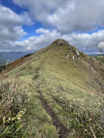
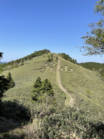
Hiruzen Sanza
"Hiruzen Sanza" consists of three peaks located in the Hiruzen Highlands: Kami Hiruzen (1,202m), Naka Hiruzen (1,123m), and Shimo Hiruzen (1,100m).
- 岡山県真庭市
- 山
 64
64 (30)
(30)
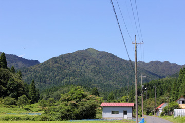
Mount Nagi
This is a mountain at an altitude of 1255m on the border of Okayama Prefecture Nagi and Tottori Prefecture Chizu.
- 岡山県勝田郡
- 山
- 63
- (45)

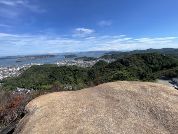
The Alps of Okayama Prefecture! Wake Alps
The Wake Alps in Wake Town, Okayama Prefecture, is a popular hiking spot where you can enjoy everything from traversing the mountain ridges to full-scale rock ridge walking, despite being a low mounta
- 岡山県和気郡
- 山
- 55
- (30)
"Mt. Sangajo Hiking in Kagamino Town
It is a 1062-meter mountain with a great view located in Kagamino Town.
- 岡山県苫田郡
- 山
- 48
- (30)
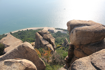
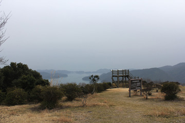
Observatory of Oujigadake
Oujigatake located in Okayama Prefecture Tamano, is a strange sight changed form of the rock tinged with huge rocks and rounded have a rumbling in the summit area.
- 岡山県倉敷市
- 展望
- 67
- (60)
Mount Kenashi overlooking the Oyama and Hiruzen
Mount Kenashi is the altitude of 1,218 meters of the mountain on the border of Okayama Prefecture and Tottori Prefecture.
- 岡山県真庭郡
- 山
- 43
- (25)
Climbing Imizuyama and Izumiyama in Kagamino Town
These are mountains located in Kagamino Town, with Mt. Imizuyama (1,150m) and Mt. Izumiyama (1,209m) offering great views.
- 岡山県苫田郡
- 山
- 25
- (10)
A low mountain adventure with a panoramic view of the Seto Inland Sea - Tenguyama and Tengunominamiyama
Tenguyama and Tengu-no-Minamiyama in Tamano City are low mountains, but they are dotted with rocks and chain sections, and offer a spectacular view of the beautiful islands of the Seto Inland Sea. Thi
- 岡山県玉野市
- 山
- 35
- (30)
Takashimizu Trail
The Takashimizu Trail is a trekking course with a total length of approximately 8.7 km that follows the prefectural border between Kagamino Town, Okayama Prefecture, and Misasa Town, Tottori Prefectur
- 岡山県苫田郡
- 山
- 38
- (30)

Ushiroyama, the highest peak in Okayama Prefecture
Ushiroyama is the highest mountain in Okayama Prefecture with an altitude of 1344m, straddling Shiso City in Hyogo Prefecture and Mimasaka City in Okayama Prefecture.
- 岡山県美作市
- 山
- 29
- (20)

Komanoyama (Okayama Prefecture)
Komanooyama in Okayama Prefecture is a mountain with an altitude of 1,281m located on the prefectural border with Hyogo Prefecture. It is a mountain connected to Mt. Goyama, the highest peak in Okayam
- 岡山県英田郡
- 山
- 15
- (10)
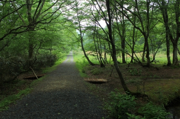
Okayama Prefectural Forest Park
This is a prefectural forest park in Kagamino Town, Okayama Prefecture where you can enjoy hiking and trekking while bathing in the forest.
- 岡山県苫田郡
- ハイキング
- 25
- (20)
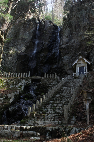
Mysterious power spot! Taki Shrine
It is a rare shrine with a waterfall in the background on the way to Mt. Nagi. It is one of the leading power spots in Okayama Prefecture.
- 岡山県奈義町
- 神社
- 71
- (10)
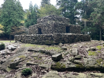
Kumayama Ruins Climbing
The Kumayama Ruins are Buddhist ruins that are designated as a national historic site and are located on Mt. Kumayama in Akaiwa City, Okayama Prefecture. It is one of the leading power spots in Okayam
- 岡山県赤磐市
- 古墳
- 57
- (30)
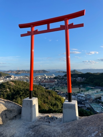
Torii in the Sky (Tamano) Good Match Kannonji Temple
Tenku no Torii in Tamano City is a torii gate built in the rocky area within the grounds of Kannonji Temple.
- 岡山県玉野市
- 神社
- 39
- (20)
Mt. Kaigara, a date spot
It is a mountain on the border of Tamano City and Minami Ward, Okayama City, and has a good view.
- 岡山県岡山市
- 展望
- 32
- (30)
Prospects for Saijo-Inari from Hachijo rock
Hachijo Rock is located in the middle of the climb from the Saijo Inari on the mountain of the Okunoin.
- 岡山県岡山市
- 展望
- 37
- (25)
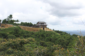
Kinojo which became a model for the island of demon Momotaro story
Ki Castle is located in Soja, Okayama Prefecture, it is the was built from the Asuka period, also became Onigashima model of Momotaro, is a fortress located at an altitude of 397 meters.
- 岡山県総社市
- お城
- 57
- (35)

Hinakurayama (Okayama Prefecture)
Hinakurayama is a mountain that straddles Mimasaka City, Okayama Prefecture, Shiso City, Hyogo Prefecture, and Sayo Town, Sayo District. It has an altitude of 1,047.4 meters and is also called ``Mimas
- 岡山県美作市
- 山
- 21
- (20)
Yudachi Ukeyama Observatory
An observatory overlooking the sea in Hinase Bay and the Okayama Blue Line bridge.
- 岡山県備前市
- 展望
- 26
- (40)


人気観光スポットまとめ
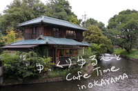
11 Recommended Relaxing Cafes in Okayama!
 50
50 90
90- 33
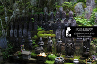
20 Hidden Spiritual Spots in Hiroshima: Local-Recommended Shrines & Scenic Sanctuaries for a Soulful Journey
- 50
 30
30- 34
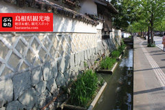
Top 30 Places to Visit in Shimane: From Izumo Taisha to Scenic and Soul-Soothing Destinations
 70
70 70
70- 32
Top 50 Places to Visit in the Chugoku Region: Scenic Highlights Across Hiroshima, Okayama, San’in & the Islands
 90
90- 70
- 31,32,33,34,35

Romantic Getaways in Okayama: 25 Scenic & Charming Spots for Couples
- 50
- 90
- 33
Top 20 Spiritual Destinations in San’in: Mystical Views, Blessings & Peaceful Escapes in Shimane, Tottori & Northern Yamaguchi
- 70
 50
50- 31,32,35
Top 15 Scenic Spots in Bitchu Area (Okayama): A Journey Through History and Nature in Takahashi & Niimi
- 40
- 30
- 33
Top 25 Family-Friendly Campsites in Okayama: Perfect Summer Escapes into Nature
 30
30- 30
- 33
15 Best Things to Do and Eat in Ushimado & Hinase (Setouchi, Okayama): A Relaxing Seaside Escape
- 40
- 50
- 33
Top 15 Things to Do Around Yubara Onsen (Okayama): Relaxing Hot Springs, Scenic Highlands & Historic Townscapes
- 50
- 40
- 33,31
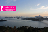
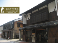
38 Best Things to Do in Kurashiki Bikan Historical Quarter: Cafés, Shops & Retro-Chic Strolls
- 70
- 90
- 33
Top 15 Things to Do Around Okutsu Onsen: Scenic Views, Local Flavors & Cultural Heritage in Okayama’s Famous Hot Spring Region
- 30
- 30
- 33,31
Top 17 Spring Flower Spots in Okayama: Cherry Blossoms, Canola Fields & Scenic Drives
- 30
- 50
- 33
Top 15 Fall Foliage Spots in Okayama: Brilliant Maples & Golden Ginkgo Leaves
- 40
- 50
- 33
15 Stylish Home & Interior Shops in Okayama: Discover Unique Furniture and Decor to Brighten Your Life
- 40
- 70
- 33

“Top 30 Places to Visit in Yamaguchi, Japan: Stunning Scenery & Rich History from Tsunoshima to Akiyoshidai and Hagi”
- 80
- 60
- 35
Top 15 Spiritual Spots for Women in Shimane: Love, Healing & Beauty Blessings
- 30
- 90
- 32
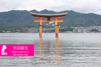
Miyajima Travel Guide: 13 Must-See Sights & Local Eats Beyond Itsukushima Shrine
- 40
- 30
- 34
Top 25 Spiritual Sites in Hyogo: Breathtaking Shrines & Temples for Nature, Love, and Energy
- 80
- 60
- 28
Top 25 Places to Visit in Western Hyogo: Explore History and Nature in Himeji, Harima & Tajima
- 50
- 50
- 28
Top 30 Places to Visit in Tottori: Stunning Sights from the Sand Dunes to Mt. Daisen and Misasa Onsen
- 80
- 60
- 31
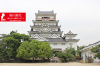
Top 15 Things to Do in Fukuyama: Discover Tomonoura, History & Scenic Views
- 30
- 30
- 34
Top 17 Things to Do in Kurashiki (Beyond the Bikan District): Hidden Gems, Scenic Spots & Unique Experiences
- 30
- 30
- 33
Top 20 Nature & Relaxation Spots in Maniwa, Hiruzen, Yubara & Shinjo: Highlands, Hot Springs & Scenic Views
- 40
- 40
- 33
Top Attractions in Northern Hiroshima: Discover Nature, Flowers & History in Miyoshi, Shobara & Sera
- 40
- 30
- 34