- Buraneta
- Activity
- Mountain-trek
- Nagano
- Kisokomagatake
Kisokomagatake
- ID:2552
 (65)
(65) (50)
(50)
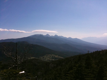
Kiso Komagatake is a popular mountain in Nagano Prefecture, with an elevation of 2,956m. Take the ropeway to Senjojiki Cirque at an elevation of 2,612m. Kiso Komagatake is a representative peak of the Central Alps, offering a wide range of spectacular views throughout the four seasons, from beginner hikes to stargazing.
The Komagatake Ropeway reaches 2,612 meters, making this a popular mountain that can be reached in about two hours. Even if you don't climb the mountain, you can enjoy the spectacular views of Senjojiki Cirque as if you were hiking.
Alpine plants bloom in the summer, the leaves turn red in September and October, and the clear air and snowy fields are beautiful in winter. If you stay at Hotel Senjojiki, directly connected to Senjojiki Station, you can reach the quiet ridge before the first train and enjoy the sunrise and stargazing.
The most common way to access the mountain is to take a local bus from Suganodai Bus Center to Shirabidaira Station, then take the 7.5-minute ropeway to Senjojiki, and then travel to and from Kiso-Komagatake via Nakadake. The Hacchozaka slope is a steep climb before reaching the ridge, but beyond that are gentle granite hills and a spectacular view of the Southern and Northern Alps. The ropeway has one of the highest elevation changes in Japan (approximately 950 meters), making it an attractive option for quick access to the alpine zone.
For regular cars, park your car at the Suganodai Bus Center Parking Lot and take a bus to Shinobidaira Ropeway Station. The bus ride takes about 30 minutes.
[Ropeway Fare]
Round trip fares vary by season (A–E):
Adults: ¥2,290–¥3,050
Children: ¥1,130–¥1,510
[Bus Fare]
Adults: ¥830 (Suganodai Bus Center Parking to Shinobi-daira)
[Ropeway Hours]
Summer: 5:00 AM – around 6:00 PM
Winter: 9:00 AM – 4:00 PM range
(Basic operation every 30 minutes)
[Ropeway Closures]
Maintenance closures (check official website)
[Suganodai Bus Center Parking Fee]
Regular cars: ¥800/day (approx. 350 spaces, around 1,000 including temporary lots nearby)
- Category
- 長野|Mountain-trek|山
- Adress
- ⧉ 長野県長野県上伊那郡宮田村4749−1 [View Map]
- Official Website
- ⧉ https://www.chuo-alps.com/
(Info may be outdated. Check official site or call for updates.)
Popular Nearby Attractions & Food Spots

Central Alps Senjojiki Cirque
- 65
 2
2- ⧉ View Map

Kozenji Temple
 48
48 14
14- ⧉ View Map

Komagane Soba Marutomi
- 46
 15
15- ⧉ View Map

Narai-juku on the Nakasendo
- 55
- 18
- ⧉ View Map

Roadside Station Minami Alps Mura Hase
- 41
- 29
- ⧉ View Map

Post town "Tsumago-juku"
- 55
 42
42- ⧉ View Map

Unexplored area of Tsukechi Gorge Fudo Falls
 35
35- 45
- ⧉ View Map

Campsite in Gifu Prefecture Tsukechi Gorges water of the river lived
- 45
- 47
- ⧉ View Map

Bansho Otaki Waterfall
- 36
- 48
- ⧉ View Map

Famous waters of the Southern Alps! Ojirakawa Valley
- 40
- 49
- ⧉ View Map

Post town "Magome-juku"
- 61
- 49
- ⧉ View Map

Tsukechi Gorge Kuraya Onsen Onpoinoyu
- 48
 50
50- ⧉ View Map

Roadside Station Kashimo
- 34
- 51
- ⧉ View Map

Nakatsugawa Onsen Kur Resort Yubuzawa
- 39
- 51
- ⧉ View Map

Hakushu/Ojiro no Mori Meisui Park “Belga”
- 55
- 51
- ⧉ View Map

Shinano Province Ichinomiya Suwa Taisha Kamisha Main Shrine
- 64
- 52
- ⧉ View Map

Sanbon Falls
- 50
- 54
- ⧉ View Map

National Alps Azumino Park (Horigane/Hotaka area)
- 45
- 56
- ⧉ View Map

Mt. Norikura
- 65
- 56
- ⧉ View Map

Nakasa, a popular soba restaurant in Gero
- 39
- 57
- ⧉ View Map

Roadside Station Alps Azumino Horigane no Sato
- 31
- 57
- ⧉ View Map

Gero spa town
- 74
- 58
- ⧉ View Map

Kitashoji Falls
- 48
- 58
- ⧉ View Map

Handmade soba Wakuri
- 38
- 58
- ⧉ View Map

Kurikinton “Suya Main Store”
- 52
- 58
- ⧉ View Map

Shimoguri no Sato Tenku no Sato Viewpoint
- 35
- 59
- ⧉ View Map

Gandate Park in Gandate Gorge
- 33
- 59
- ⧉ View Map

Hoshino Resorts RISONARE Yatsugatake
- 35
- 60
- ⧉ View Map

Soba Club Sasaki
- 47
- 61
- ⧉ View Map
[Selections]Popular sightseeing spots around Nagano Prefecture
「mountain-trek」Sightseeing spots around Nagano Prefecture
Mt. Norikura
Mt. Norikura is a popular climbing spot with numerous climbing courses that can be enjoyed by everyo...
- 56
- [+]長野県長野県
- 65
To Kitayoko dake from north Yatsugatake ropeway
The Kita Yatsugatake Ropeway is located in Kitayama, Chino City, Nagano Prefecture, and takes about ...
- 77
- [+]長野県茅野市
- 60
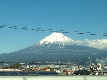
Fuji Mountain
Mount Fuji is the highest mountain in Japan, boasting an elevation of 3,776 meters. Its graceful con...
 135
135- [+]静岡県
 95
95

The Mystery of Emeralds! Mount Kusatsu-Shirane
Mount Kusatsu-Shirane is one of Japan's 100 famous mountains, located near the border between Gunma ...
- 157
- [+]群馬県吾妻郡
- 45
close
×
![modal]()